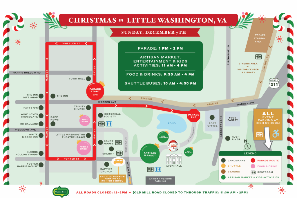
Use this map as a guide to find all the fun activities and venues for the day of the parade. View the map, below, or tap the links for a downloadable and printable version of the map.

Parking
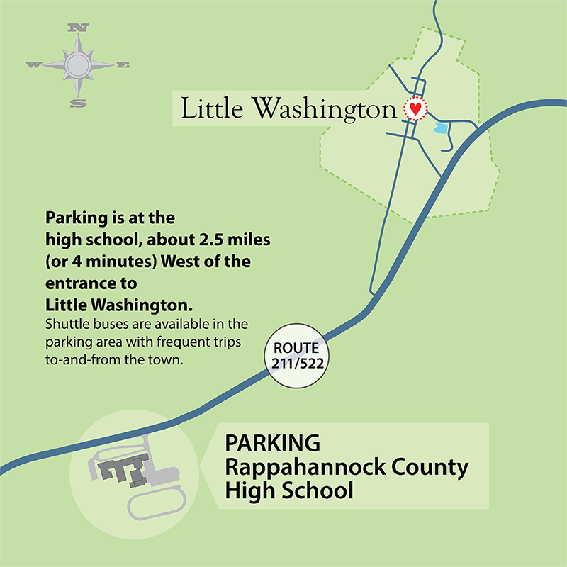
General event parking will be at Rappahannock County High School with frequent shuttle buses to get everyone safely to-and-from the event. Please park at the high school, hop on a shuttle bus for a quick, five-minute ride into the town and enjoy the day!
Shuttle buses will return you from town to the high school parking area throughout the day up until 4:30pm when the final shuttle bus departs for the high school.
Handicap parking begins at 10:30am for those who need transportation for wheelchairs and is now at Rappahannock County High School (changed from Rappahannock County Park).
Address for all Parking at Rappahannock County High School
12576 Lee Highway,
Washington, VA 22747

Below is a Google Map with more detail. Click this to view a larger map in a new browser tab and find directions from your location.
Address for Parking at Rappahannock County High School
12576 Lee Highway,
Washington, VA 22747
